How to navigate using a GPS chartplotter
A chartplotter is one of those boat accessories that after you buy one, you wont be unable to understand how you lived without it. Once confined to paper and pen, the art of chartplotting on today's touch-screen units makes the navigation process headache free.
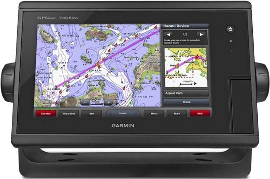
What is a chartplotter?
A chartplotter is a device that integrates GPS satellite navigation with charts of the water and the coastline, allowing you to accurately place yourself on the map and track your speed and direction. Most chartplotters have the capability to store hundreds of custom routes, each with their own waypoints and route info.
Chartplotters are generally very simple, and using them involves two steps: setting a waypoint in the water, and then navigating towards it. The tricky part arises when it comes to exactly how to do this on your specific unit. Below are two videos from Garmin on how to carry out these two steps on some of their units, such as the Garmin echoMAP 7412xsv.
1. Enter the waypoint
The first step is to enter the waypoint or waypoints you wish to navigate to. On the Garmin models shown below, this can be done in a variety of ways, such as marking your current position or entering the coordinates:
2. Navigate to the waypoint
The next step is to navigate to the waypoint you've set, which is especially easy on Garmin models like the echoMAP CHIRP 75SV:
Some quick tips to remember
- When navigating in shallow or tricky waters, zoom your chartplotter in as far as it will go. This is because the graphic representation of your boat often won't change size when you zoom to different levels. When zoomed way out, your boat may look the same size as when you're zoomed all the way in, so you won't be able to accurately judge where the edges of your boat actually lie.
- It's always a good idea to have a compass and paper charts on board even when you have a chartplotter. If the device ever fails, having hard copies onboard will prove invaluable.
- One of the handiest uses for a chartplotter is recording that favourite fishing spot of yours. Many chartplotters - including the Garmin units - have the ability to set a waypoint at the boats current position. So if you're unsure of the exact coordinates, you can simply record the position in your systems memory while you're there.
For more information on marine accessories and electronics, get in touch with the team at Hunts Marine today.
